
Hull Geological Society
Mike Horne FGS
This is unfinished work that has not been edited or peer reviewed by the Society.
"The
marl bands of the northern Chalk and their origin".
by
Mike Horne
Abstract :
130
samples of marl bands were taken at semi-regular intervals throughout the
Yorkshire Chalk (about 400m thick) and were analysed with an XRF spectrometer .
Some of the Marls in the Turonian and Coniacian Chalks contained significantly
higher than average quantities of Zirconium, Yttrium and Niobium, indicating
that these may have a volcanic origin. These marls are : the Ulceby, Lower
Deepdale, Melton Ross, North Ormsby and Upper Deepdale marls ( with over 600 ppm
Zr). Other marls showed moderately high levels : the Rowley marl
no. 4 and Barton Marls nos. 1, 2 and 4 ( with
200 to 350 ppm Zr).
Marls from the
Cenomanian, Santonian and lower Campanian did not
have such high levels.
The marls from the
Flamborough Formation (Santonian and lower Campanian) tended to exhibit lower
values and less variability for Lead, Nickel, Copper and Zinc and higher values
for Rubidium, when compared with the marls from the younger chalks. Tests on the
Ulceby, Grasby, Melton Ross and some other marls, and Black Band materials
showed fairly consistent values across the region.
Introduction :
The Chalk is a pure white bioclastic limestone.
In Yorkshire it is about 400 metres thick and to most people it all looks very
much the same - a white rock which, if you look closely, contains white
fossils., some flint bands and some clay bands.
The band have been used to correlate the
stratigraphy in the region and have been named by Chris Wood (Wood
& Smith 1978, Gaunt et al 1992 ) and Felix
Whitham ( 1991 & 1993 ), though some of the flints may be diachronous. The marls
bands have also been used by Chris Wood (e.g. Gaunt et al. 1992) for correlation
with other regions, e.g. East Anglia, southern England and Germany. The
stratigraphy in this paper is based on personal observations and using the names
already published, plus some new ones.
The Upper Cretaceous Chalk contains layers of
calcareous clay,
known as marl bands. In the Northern Chalk, and
sometimes in the Southern Chalk, these are very distinctive, with abrupt bases
and tops. There is usually no bioturbation of the marl into the underlying
chalk, or of the overlying chalk into the marl.
Macrofossils are sometimes visible in the field
in the marl bands. They often contain patches of iron oxide minerals, and
occasionally iron sulfide minerals (which oxidise on weathering). Green coloured
glauconite can sometimes be observed in the field.
As the marls are soft, they are often eroded,
especially at coastal exposure, forming a negative feature in a cliff or quarry
face. They are very prone to colonisation by plants, and in abandoned quarries
or on some cliffs, the marls are often picked out by a line of green vegetation.
For a considerable time there has been
discussion about the origin of the marl bands, whether they are the result of
solution of the chalk naturally enhancing the percentage of clay minerals, the
formation of new minerals during diagenesis or are representatives of tuff
layers. Jeans (1968) studied the clay
mineralogy and concluded that the
montmorillonite in the Cenomanian chalks was neo-formational and detirtal. Chris
Wood
(Gaunt et al. 1992) suggested that the "buttery" marls
were argillated ash falls.
I have often wondered about this and thought it
would be useful for stratigraphy if the marl bands had a microfossil or
geochemical “fingerprint”,
so that we could place small exposures in their
correct stratigraphical level. A few years ago Richard Middleton in the
Department of Geography at the University of Hull, offered me the opportunity to
run some samples through an x-ray fluorescence spectrometer (XRF). The first few
samples showed an interesting variation in results, so more samples were tested
to see if a pattern emerged. Unfortunately the XRF machine was scrapped before
the project could be completed.
Methods.
Samples of major marl bands were collected,
attempting to cover
the complete succession of the chalk and also
test regional
variation.
The samples were dried and then whole samples
were
powdered in a ball mill. They were not treated in any
other way, so that the chalk content in the samples varied. The powder was
then pressed into pellets and analysed in a
Philips PW1410 X- Ray
Fluorescence Spectrometer. Results for the
following elements
were obtained for most of the samples : Cu, Zn,
Ni, Pb, Sr, Rb, Y, Nb and Zr. All results are given as parts per million (ppm).
A list of the sample numbers and localities is
given in table 1 and the results are given in
table 2.
This occurs
above an erosion surface and below a black carbon
rich clay. It contains well preserved fish
teeth, a varied
microfauna and occasionally nests of
'terebratulids' and very rarely the
belemnite
Actinocamax
plenus.
NEH5
EL3
GD21
KNA2
Sr
442
380
312
347
Rb
31
32
35
38
Y
30
32
53
37
Nb
4
8
5
6
Cu
38
41
36
40
Zn
81
41
72
51
Ni
59
66
69
67
Pb
28
20
16
23
The Ulceby Marl.
This marl
occurs towards the top of the Sternotaxis plana zone,
approximately 91m
from the base of the Chalk on the composite log. It is commonly more than 4cm
thick and is notable for the well preserved
Bourgeticrinus
that can be found in it.
UL1B
EN11
KP2B
NL1B
Sr
444
341
507
329
Rb
20
18
14
20
Y
88
84
52
94
Nb
28
50
17
82
Zr
455
811
77
997
Cu
31
42
20
39
Zn
94
182
54
182
Ni
25
76
21
86
Pb
20
22
17
30
Comparison of
marls with other materials
SPE65
EP2
BEV9
KIM
C9B
D7
Average Marl
Sr
477
808
831
293
228
654
523
Rb
35
3
9
152
130
10
42
Y
50
7
9
22
25
108
45
Nb
9
1
1
16
28
205
19
Zr
81
18
37
123
159
908
177
Cu
11
15
13 26
Zn
55
20
24 64
Ni
56
16
13 52
Pb
22
4
5 12
Sample is Red Chalk
from Speeton , EP2 Coniacian Chalk and BEV9 Santonian (flint free) Chalk. Sample
KIM is Kimmeridge Clay, C9B a phosphate rich clay and D7 a bentonite clay all
from Speeton.
Unusual results :
Samples MEL23
and GD22 are the black clay from the Black Band Member, a carbon rich
clay containing fish scales and a depleted
microfauna.
This black clay is thought to represent an
anoxic event (OAE2) when oxygen deficient water flooded onto the shelf killing
most of the benthos (ref ....). Sample SF51 is the basal Cenomanian marl from
South Ferriby and probably represents a condensation/transgression event. These
produced a set of results which are ......
low in ... but rich in ..... When
and
are plotted against
and
(see fig
) these form a distinctive group. Interestingly
the samples of the Middleton Marl plot in a similar position on that graph.
Could this also be a sign of anoxia or a some condensation of the sequence ?
In the field
dark grey patches can be found in the Middleton Marl which as reminiscent of the
black clay in the Black Band Member.
New stratigraphic names
:
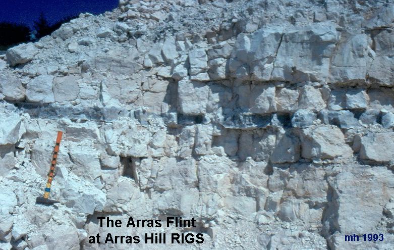
Arras Flint., A carious tabular flint between the Enthorpe Marls and the Kiplingcotes Marls near the top of the Turonian Chalk. The top is flat and the base is undulating. Type Section is Arras Hill Quarry (RIGS)
Marsupites Marl.
A thick indurated marl to be seen S W of Danes
Dyke, which
contains numerous plates of the
crinoid
Marsupites
References :
Gaunt G
D, T P Fletcher &
C J Wood, 1992.
Geology
of the country around Kingston Upon Hull and Brigg.
British
Geological Survey Memoir.
Jeans C V
1978. The origin of the montmorillonite of the European chalk with special
reference to the Lower Chalk of
England.
Clay Minerals 7,
311-329.
Whitham F
1991. The Stratigraphy of the Upper Cretaceous Ferriby, Welton and Burnham
Formations
north of the Humber,
north-east England.
Proceedings of the Yorkshire Geological Society
48,227-254.
Whitham F
1993. The stratigraphy of the Upper Cretaceous Flamborough Chalk Formation north
of the Humber, north-east
England.
Proceedings of the Yorkshire Geological Society
49,235-258.
Wood C J &
E G Smith 1978. Lithostratigraphical classification of
the Chalk in North Yorkshire,
Humberside and Lincolnshire.
Proceedings of the Yorkshire Geological Society
42, 263-288.
Copyright - Hull Geological Society 2022
Registered Educational Charity No. 229147