
Hull Geological Society
Copyright Hull Geological Society.
News archive 2019-2020
We held one geology walk for the Festival of Geology in November 2020 following the Government's Covid Guidelines - one leader and one person from a different household. Mike led Bryony on a guided walk of Hull's General Cemetery. The walk around the city centre was cancelled.
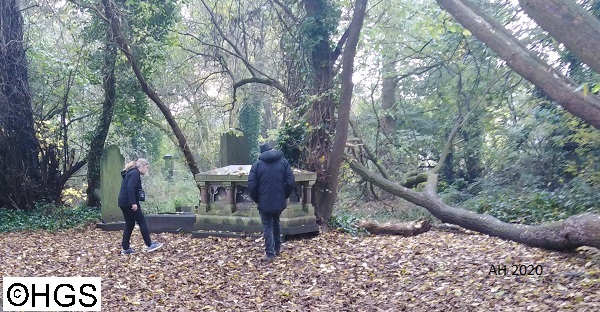
Festival of Geology walk (photographed from a distance).
Due to the second Covid Pandemic Lockdown in November 2020 our planned field meetings have been cancelled by the leaders.
The HGS Committee has decided to waive the annual subscription for 2021 for members who have paid their subs for 2020, because we have not been able to provide the full Summer and Winter Programmes due to the Pandemic. Our running costs have not been reduced substantially so donations would be most welcome!
The HGS Committee has introduced extra Risk Assesments for meetings held during the Covid Pandemic, with effect from 26th August 2020 .
The Yorkshire Geological Society is publishing a series of virtual field trips and guides that you can download. The series includes a guide to the cliffs at Bempton and a self guided tour of Hull's Western Cemetery,
Changes to our Data Protection Policy and Procedure - In light of the Coronavirus pandemic lockdown the Committee has made changes to the Data Protection Policy and Procedure. To avoid a ‘single point of failure’ your personal data will be shared between the Officers of the Society who are expected to keep to the terms and spirit of the Procedure. Officers may share you data with the emergency services if they think your health and welfare is at risk. Leaders and organiser of Society events may collect and keep a paper record of the people attending the event for a specified period at times of a health pandemic. Please see the HGS website for the full details or request a printed copy.
June 2020 - The Committee had decided that we would not hold any further field meetings until we knew whether the public liability insurance is still valid during the Coronavirus pandemic. The Geologists' Association (who arrange the insurance) has informed us that we can go ahead with meetings as long as we follow UK Givernment guidleines. It is likely that booking will be required for these meetings to comply with the guidance on the number of people attending.
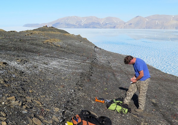
We are so sorry that we have had to cancel or postpone events because of the Covid pandemic. The Committee had a virtual meeting in May 2020 and decided that we should wait until the University of Hull provides definite dates for re-opening for lectures (rather than on-line teaching) before we finalise plans for our Winter Programme. Our Roadshows have been cancelled because the venues have been closed. Social distancing has meant that people have not booked for the field meetings. One Yorkshire Geology Month event was held in May with just two people (following Governement guidelines) to ensure continuity of the YGM since it was started in 2005 by Mike Horne and the HGS.
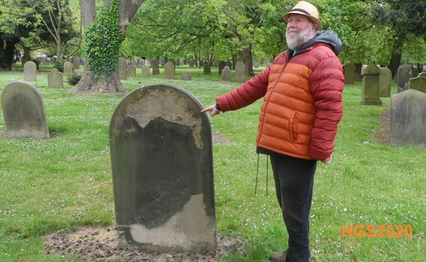
Mike Horne leads the Yorkshire Geology Month
walk in Western Cemetery (Hull) in May 2020
20th March 2020 - we have created a Facebook Club Page so that members can take part in virtual Club Nights. Members who have paid their annual subscription can join: visit https://www.facebook.com/groups/555124668431623/ or look search Facebook for "Hull Geological Society club page"
Thursday 14th November
2019
- (evening lecture) - Chris Darmon (of GeoSupplies) on
"The Geology of Southern Norway"
Abstract –
During the
Quaternary, repeated glacial cycles left widespread deposits across Britain.
These deposits hold an archive of terrestrial responses to changes in climate
over the last 2.6 Ma. One such archive is the Vale of Pickering in North
Yorkshire: A low-lying depression bounded on all sides save the east end by
large hills comprised of Jurassic and Cretaceous bedrock. During the Late
Quaternary, this natural basin was blocked by ice sheets forming large
proglacial lakes. To understand the advance and retreat of the surrounding ice
lobes in the Vale of York to the west and the North Sea Lobe to the east – the
deposits of the Vale of Pickering are crucial; however, limited work in the area
has failed to ascertain an accurate history of Lake Pickering. Using newly
available high-resolution LiDAR data, field observations, historic borehole
records, and optically stimulated luminescence (OSL) dating, a new chronological
model for Lake Pickering has been established. This shows that 1) previously
estimated lake levels are too high and that during the LGM, Lake Pickering was
no more than 33 m O.D. 2) Ice invaded the eastern coast of the Vale of Pickering
on more than one occasion, potentially earlier than the LGM. 3) Several
iterations of Lake Pickering exist with a lake during the LGM, but at least one
older than 30 ka. 4) The drainage of Lake Pickering is very complex and seaward
drainage likely prevailed until the eastern end became blocked by continued
deposition of glacial material. This reversed the drainage through the Kirkham
Gorge. 5) The use of newer geoscientific techniques like OSL and LiDAR mapping
are crucial to the understanding of the palaeoenvironment of the Vale of
Pickering and the continued development of these techniques are vital to further
work.
Ian
Heppenstall died of a heart attack on 9th March 2019, aged 72. His
funeral was in the small chapel at Chanterlands Avenue Crematorium at 1pm on
Monday 25th March. A collection was made for Parkinson’s Disease.
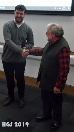
Whitham Medal 2019
The Felix Whitham Memorial Medal is awarded to Lewis Rose for his contribution to the understanding of local geology through the new Geology displays at Hornsea Museum. The medal is awarded “for contributions to new research into the geology of eastern Yorkshire or northern Lincolnshire, or it may be awarded for active contributions to geological outreach projects in the Hull area…."
Thursday 28th March 2019 - Dr Lyndsey Fox of Hull University on "Illuminating
Anthropogenic climate change with 150 years of ocean science"
Abstract -
"Modern oceanography began with the HMS Challenger expedition from 1872 to 1876. This historic voyage was the first to specifically gather data on a wide range of ocean features, including ocean temperatures, seawater chemistry, currents, marine life and the geology of the sea floor. With the 150th anniversary of this momentous voyage fast approaching (2022), I aim to take the historical endeavours of this seminal expedition and combine them with 21st century cutting-edge science to tackle some of the most urgent questions of our time with regards to anthropogenic environmental change. The vast quantities of Challenger plankton tow material housed in the Natural History museum collections offers a singular opportunity to spotlight one of our most pressing environmental issues: ocean acidification (OA).
"Both measured and projected changes in seawater
chemistry have potentially catastrophic biotic effects as OA hinders biogenic
carbonate production, leading to substantial changes in marine ecosystems.
Current attempts to address this issue via laboratory based studies have serious
limitations, which can only be overcome by comparing newly discovered plankton
tows from the historic HMS Challenger expedition (1872-1876) with the
ground-breaking TARA expeditions (2009-2016).
"Here we discuss the untapped
potential of historical collections for gaining new insights into the
sensitivity of the global climate system to CO2 forcing, as we present new data
gathered over the past 12 months from two test sites in the tropical Pacific
Ocean. These data revealed, without exception, that of the 24 specimens analysed
through nanno-CT scanning; all modern foraminifera showed significantly thinner
shells compared to their preindustrial counterparts (Figs. 1-3). Open ocean
studies, such as this, are urgently needed to understand the impact of
multi-stressor environments on shell parameters of multiple species, and reveal
the magnitude of OA across the globe.
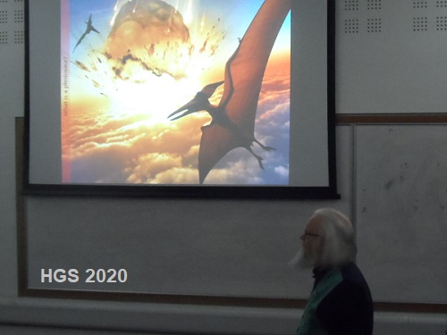
Thursday 21st March 2019 - Evening Lecture - Prof David Bond of Hull
University on "When life nearly died - new perspectives on the
Permian-Triassic mass extinction
At the end of the Permian, 252 million years (Myr) ago,
Earth suffered its greatest ever crisis during which around 90% of living
species were wiped out. Almost every group was affected, on land, and in the
oceans, and it is the only mass extinction of insects. This truly was "the day
the Earth nearly died" (although it lasted significantly longer than a day!).
This was an event so catastrophic that it wiped the evolutionary slate clean,
ultimately paving the way for the rise of the dinosaurs (and then, of course,
humans). But what could possibly have caused such a disaster?
Despite controversy over the
timing of losses, radio-isotopic dating indicates that extensive damage was done
to both terrestrial and marine ecosystems in a very brief interval around the
end of the period. The focus now is on understanding the role of the proposed
kill mechanisms, including (in no particular order): global warming, ocean
anoxia (deoxygenation) and acidification, volcanic winter, hypercapnia (CO2
poisoning), aridity on land, increased sediment flux to the oceans, ozone
destruction and resultant harmful ultraviolet-B radiation, acid rain,
atmospheric oxygen depletion, and poisoning by toxic trace metals. Each has
probable origins in Siberian Traps volcanism, in particular the vast volumes of
gases (e.g. CO2) that must have been released. The latest work is beginning to
reveal the likeliest culprits: extreme global warming and its knock-on effects,
perhaps coupled with an acidification crisis in the oceans.
Lower Triassic marine strata of the Sverdrup Basin
(Arctic Canada) include a thick succession of sandy and silty facies that record
life in the aftermath of the end Permian mass extinction. Proxies for
oxygenation (trace metals, pyrite framboids) suggest that dysoxic conditions
prevailed in the Basin for much of the Early Triassic. This suppressed
bioturbation and allowed the frequent development of microbially-induced
sedimentary structures (MISS), including wrinkle structures, Kinneyia and bubble
texture. The microbial mats responsible for these structures are envisaged to
have thrived, in dysoxic settings, within the photic zone, on fine sand
substrates. The dysoxic history was punctuated by better-oxygenated phases,
which coincide with the loss of MISS. Thus, Permo-Triassic boundary and
Griesbachian mudrocks from the deepest-water settings have common benthos and a
well-developed, tiered burrow profile dominated by Phycosiphon. MISS are also
lacking from Skolithos-burrowed, nearshore sandstones that developed during
basin-wide oxygenation in the late Dienerian. Intervals of the intense burrowing
in the earliest Triassic contradicts the notion that bioturbation was severely
suppressed at this time due to extinction losses at the end of the Permian.
Thursday 21st February 2019 - Evening Lecture -
Prof Chris Clark of Sheffield University on
the
"Retreat
of the last British-Irish Ice Sheet
We have known for a long
time that a kilometres-thick ice sheet largely covered Britain and Ireland
during the last glacial, peaking at around 27,000 years ago. Most evidence for
its geometry arises from tens of thousands of geological and geomorphological
observations, but almost wholly restricted to land. The earliest researchers
(e.g. Geike 1867) were happy to use simple glaciological logic (presumed ice
sheet symmetry) to reconstruct ice margins that reached far offshore and to the
continental shelf edge. Such views were rejected by more conservative and
evidence-based approaches that followed, leading to reconstructions of a mostly
terrestrially-restricted ice sheet. Numerical ice sheet models of the time did
what they were told regarding ice limits. Over the last decade the focus of
investigation has moved offshore, enabled by new high resolution bathymetric and
shallow seismic data, and leading to a ‘gold-rush’ of discoveries that have
transformed our understanding. The continental shelf has abundant evidence of
grounded ice cover.
The BRITICE-CHRONO consortium of researchers has been a six year project to constrain the timing of retreat of the British-Irish Ice Sheet by a systematic dating programme focussed on the marine-to-terrestrial transition. From two research cruises some 18,000 km of geophysical data and 377 vibro- and piston cores, along with many stratigraphic sections on land have been used to provide material for dating. The aims and objectives of the project and progress thus far will be reported along with some highlights from the various transects under investigation. The new BRITICE Glacial map of Britain and Ireland will be shown which contains some 170,000 glacial landforms.
A unique piece of geo-art is for sale. For the "On the Endless Here" collaboration between local artists and members of the Society, Anna Kirk-Smith created a piece called “With a Learner’s Faith”. Anna is now moving to a smaller studio in Bridlington and would like to sell the work to a interested geologist rather than auction it. If you would like to make an offer please email the HGS Secretary.
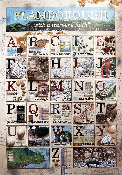
Anna describes the work -
This painting / construct was part of the On the Endless Here show; the
accompanying description is below. It is on MDF / wooden frame with a
painted/drawn surface and 3D objects/fossils. It is quite large - approx. A1 in
size.
This once was how the George Lamplugh described his approach to his
studies of the Pleistocene tills and fossils at Bridlington Crag, including
Danes Dyke, South Landing and Sewerby, my initial stomping grounds. He began his
field observations in 1878, at the tender age of 19 years and was a descriptive
genius. I put my “learners faith” (utterly devoid of genius) in the Hull
Geological Society and began the exploratory field trips with the members to the
headland (sagely noting the white stone, and overlying brown ooze), beyond that
observation in these initial days they could have been talking a foreign
language. My early field book notes consist of a list of geological jargon with
question marks beside them (for later looking-up in a dictionary), and copied
(thankfully idiot-proof) diagrams that Mike Horne drew in the sand with his
umbrella to explain the surroundings. Initially it didn’t help that this was a
questionable landscape – I was trying to comprehend the unknown, the
hypothesized, about a terrain that just kept throwing geological curveballs.
However once I had settled into the frame of mind that 2+2 might equal 4, 5 or
indeed any other random integer potentially proven or disproven by sampling; I
became less worried by predetermined fact and more intent upon potential areas
of enquiry.
After 2 years of field visits, gone to me is the visually
nice white chalk topped with that ooze of brown mud; and an appreciation has
appeared of forensic searching for biostratigraphical fossils, posing reasons
for folding and faulting, descriptions of marl content, determining the age and
colour of till samples, magnifying grains of sand to distinguish the processes
they have undergone, pondering the far flung origins of glacial erratics and
weaving predictions around the size, sorting, orientation, shape and turbation
of chalk clasts. Within these lay the foundation for the headland’s narrative
probability.
So this particular artwork sprang from that empathy with
Lamplugh’s initial search of an unexplored, misunderstood terrain. He possessed
far more knowledge than I when he studied the headland, so as a complete
initiate, I have in the artwork reverted to a primary Victorian method of
learning: the ABC, and added a flavour of my research, queries, field notes and
visual perceptions I had to forage for in order to try and understand some of
the geological riddle of Flamborough."
Click here for the On the Endless Here Facebook page. There is also an OTEH website projects page on www.annakirksmith.com
Thursday 17th January 2019 - Evening lecture - Dr. Michael Oates on "Exploring Morocco's Palaeontological Riches".
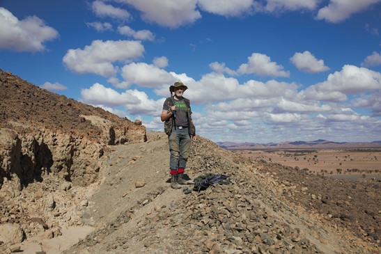
The speaker on a heavily dug hillside of Devonian mudstone near Tazoulait
Abstract -
The southeastern part of Morocco lies within the limits of the Sahara Desert and
is an arid desolate, scarcely inhabited environment, with an undulating eroded
basement of folded Palaeozoic sediments beneath an unconformable cover of
horizontal Cretaceous deposits. The common theme to all these sediments is that
they have suffered relatively little structural or thermal modification and are
very fossiliferous. An overland expedition in early 2018 examined the geology
in three areas of southeast Morocco, near Taouz, Alnif and Goulmima, which is
just at the margin of the Atlas mountains. Because the African continent has
remained fairly stable throughout Phanerozoic time, there has been less burial
than might be expected, and the preservation of the fossils is correspondingly
excellent. Expect to hear about Ordovician trilobites in abundance, a surprise
Silurian limestone with 3D graptolites, Devonian shelf faunas and Upper
Cretaceous freshwater to marine fossils, and how they are found. Without the
restrictions of a 20kg airline baggage allowance, as many specimens as I can
carry will be available to view on the night.
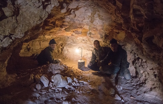
Ammonite, Fish and Reptile miners of Asfla
Copyright - Hull Geological Society 2024
Copyright Hull Geological Society.
Registered Educational Charity No. 229147