
Humberside Geologist no. 16
Report of the Bisat
Project
By Dennis Haughey
W.S. Bisat
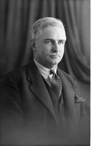
William Sawney Bisat, (1886-1973), earned his living as
a civil engineer for most of his life; it was this that probably drew him into
his passionate interest in geology. Amongst other things he had a particular
interest in the stratigraphy of the Holderness coast. He was a brilliant man, he
must have been because at one time he was President of the Hull Geological
Society! He had a huge range of interests and published a range of well received
scientific papers. His life is well worth a little research on the internet, it
is an inspiration to us all.
Between 1932 and 1952 Bisat
walked the 56 kilometres of coastline between Easington and Sewerby.
The 2nd World War caused him to drop his task for several years.
He sketched and described the stratigraphy along
this whole coast and finally at the end of his marathon walk he combined his
findings onto a single sketch on a roll of paper 8.2 metres long.
At the time he was living in North Ferriby so the logistics of getting to and
from the coast and up and down the cliffs whilst still working full time as a
civil engineer must have been quiet daunting. (My first car was a 1932 Austin
7 and it was reliable and comfortable so Mr Bisat probably travelled in some
comfort and style). He probably had assistance in his task, but we have no
record of that.
The project
Sometime in 2014, Mike Horne
had the idea that someone, or some people, may like to replicate Bisat’s 1930s
work on the Holderness coast. At first there was a large response and a few
groups got together on the beaches, but we quickly recognised the enormity of
the task. After a few false starts Graham Kings agreed to take on the job.
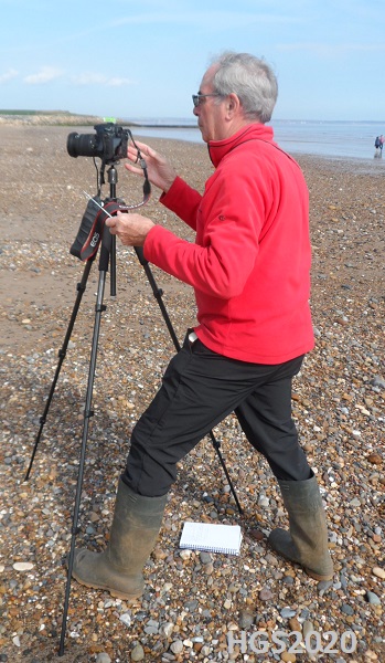
Rather than sketches, Graham, who is interested in photography, decided that
he would take photographs of the whole of the coast and then somehow stitch
them together once they were all taken.
On 22nd April 2015
Graham took his first photograph, using the edge of the Sewerby Buried Cliff
as his northern marker and a long scaling pole as his southern marker 30
metres to the south of the Buried Cliff. He positioned his camera, on a
tripod, 30 metres out from the cliff. This pattern was repeated for the whole
of the next 56 kilometres; more than 1514 photographs in total. The last
picture was taken on Monday 30th September 2019.
The photographs will be
printed onto individual A4 sized sheets creating a record 455 metres long thus
dwarfing Bisat’s original huge sketch. All the photographs will have an
accurate GPS location marked on them and they will be filed in accordance with
the coastal visits thus creating approximately 50 separate folders.
Graham did all of the
photography and he is the only one that walked the whole of the coast. He did
have help from quite a number of people, including his wife Pam and in
particular Rodger Connell, who did just about all of the walk. Also Dennis
Haughey, Arthur Speed and many others who each did some of the walk.
The logistics of the task are
a little surprising, here are a few:-
·
Each visit, and
there were more than 50 included at least 3 cars, each car covering about 40
km, about 6,000 km motoring in total.
·
Each kilometre of
coast took at least 3 km of walking including to and from the cars and to and
from the start point for the photographs. On each visit there was a group of 3
people, a total of more than 500 km walked.
·
Most importantly
each visit included a debrief in the most local coffee shop, at least 3
coffees per person, so about 500 coffees were bought, thus helping the local
economy somewhat.
These visits were very
pleasant, we got to be on speaking terms with many local people…one of the
most memorable was Dot from Withernsea. She is a retired farmer and is a very
knowledgeable local historian.
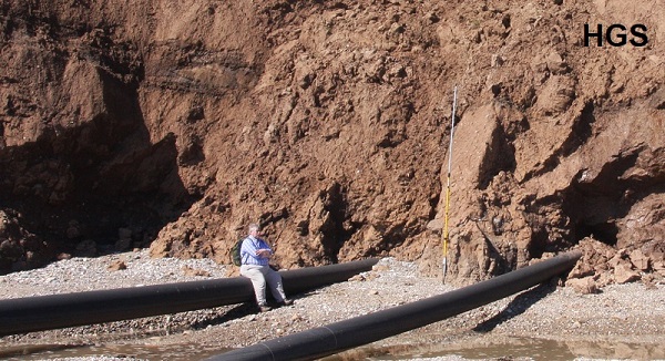
Perhaps the most difficult aspect of the task was
getting access to the cliff top and then down to the beach. The public have
rights of access to all of the beach, apart from a short area where there are
all kinds of live and dead ordnance just laid around on the surface. However,
in general the cliff tops are privately owned, mainly by farmers but also
caravan sites, gas treatment plants etc. The cliffs at Easington are protected
by armed police. Eventually we got to know many of the owners and operators
and without exception they were cooperative with us.
(Picture by G Kings, 2016)
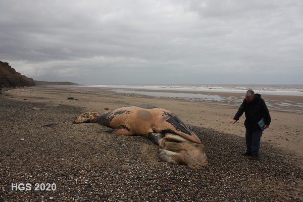
It’s surprising what one finds on the beach…nudists…dead whales…fishermen
galore….but they are other stories.
The project team included Rodger Connell, the late Derek Gobbett, Dennis
Haughey, Annie and Mike Horne, Stuart Jones, Graham Kings, Brian Kneller,
Arthur Speed and Paul Thornton.
copyright Hull Geological Society 2020