TRANSACTIONS OF THE HULL GEOLOGICAL SOCIETY
Volume 1, pages 6-8
REPORT OF THE EAST RIDING BOULDER COMMITTEE, 1893-4.
This Committee was formed early in 1893 for the purpose of observing and systematically recording the glacial phenomena of the district.
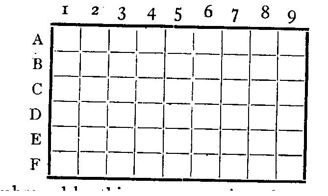
The map of the Ordnance Survey Sheet 94 S.W. (new series 72) which embraces the district immediately to the N. and N.W. of Hull, for convenience in working, was divided into fifty-four squares,
The area embraced by this map contains about 216 square miles, and consists of three principal physical divisions. To the west we have a part of the great Holderness flat, to the south west a portion of the plain of York, while between the two is the southern part of the range of hills known as the Chalk Wolds.
The first year's work of the Committee has consisted in the careful search for erratic blocks, chiefly in the S.W. part of the district, the area covered being about 72 square miles.
Squares
D1,D2, E1, E2,F1,F2 -
Mr. J. W. STATHER, F.G.S., reports :--
The only unquestionable foreign boulders seen in this area are two or three water-worn blocks of whinstone, used as curbs in the stree ts of North Cave, the largest being 18in. x 12 in. x 12in. A few small blocks of sandstone (possibly Carboniferous) were seen in the gravel pits south of Market Weighton.
Mr. F. F. WALTON, F.G.S., reports :
D3. Nothing found.
E3. Near N.W. corner of Newbald Church on the mad side, rounded water-worn boulder of red granite, no scratches, 13in. x 9in. x 5in. Five yards north of above, also on the road side, a water-worn boulder of hard limestone, 15in. × 8in. x 7in.
F3. On the road from South Cave to Newbald, between old toll house and corner of road to North Cave, water-worn boulder of lime- stone; 3½in. x 8in. x 8in.
D4, E4, F4 Mr. W. S. PARRISH reports :--This district lies on the ridge of the Yorkshire Wolds, and is singularly free from hamlets and villages, isolated farm houses and cottages only being met with. In the neighbourhood of these houses a small number of igneous blocks were seen, but these were not worth recording, as they were very small and evidently not in situ.
Mr. T. R. WILLIAMS reports :-
E5 That at the village of Walkington, in front of the "Dog and Duck" Inn, there is a group of boulders of some importance, which have however evidently been moved there. Several of these (say four) are dolerite. One is shale with a considerable quantity of mica, and a large boulder 4ft. x 2ft. x 2½ft. is probably millstone grit. There is also one boulder of Shap granite. The boulders are well rounded but not striated.
D5 Boulders at Bishop Burton.--(1) Boulder of Carboniferous Limestone with encrinital stems, of a very coarse crystalline structure, 18in. by 15in., on the south side of the road, about 100 yards west of the Inn "Altisidora." (2) Fine grained basalt boulder at the same entrance. (3) Large, very coarse grained boulder of basalt (dolerite) at the west, end of the village. (4) Another similar to No. 3 near the Primitive Methodist Chapel, 3ft by 2ft., well rounded. (5) Several Oolitic stones, probably not glacial boulders, scattered about the village.
F5, F6 Mr. THOMAS THELWALL reports :--There are several whinstone blocks in this district, water-worn but not striated, varying in size from 26in. x 18in. × 16in. to 18in. × 16in. × 16in., used by the farmers for horse blocks and similar purposes.
Mr. J. W. STATHR, F.G.S., reports :--
E6. From boulder clay resting on the chalk at the pit south of barracks on Bentley Road, boulder of Carboniferous Sandstone, with fossils.
D6. From boulder clay at Judge's chalk pit, near Chalk Villa--(1) Boulder of garnetiferous mica schist, 6in. by 3in. by 2in. water-worn ; (2) granite boulder, 6in. by 3in. by 2in.; (3) Many whinstone boulders, (small).
E7. Mr. W. H. CROFTS reports :-. Three boulders of whinstone in the village of Cottingham used as curbs : (1) Corner of Park Lane and Northgate, 2ft. by 1ft. 8in. by 18in., water-worn; (2) Left hand side of Park Lane, 200 yards north of above, boulder 2ft. 8in. by 2ft. 3in. by 4in., fiat planed top surface, well striated; (3) Weigh-house yard, King Street, 2ft. by 2ft. by 18in., waterworn. Near gate of Clay Hill Cottage, Dunswell Lane, boulder of whinstone, 3½ft. by 3½ft. by 2ft., water-worn.
F9. Boulders at or near Sutton-on-Hull, reported by Mr . W. F. ROBINSON. They have been used for door-steps, corner- stones, stile-stones, &c. (1) Limestone, stile stepping-stone near Sutton School, 4ft. by 2ft. by ¼ft. (2) Basalt, ft. by ft. by 9in. in Swine footpath. (3) Limestone, and (4) Basalt, in front of a gateway nearly opposite the school. (5) Lias limestone with Gryphaea, in front of blacksmith's shop, 2½ft. by 2½ft. 6, 7, and 8, etc. A cluster of various rocks in main street at end of Hull and Sutton footpath: Mountain Limestone, over a foot in diameter ; basalt, 1ft. by 1¼ft. by (?) ; granite, 3ft. by 2½ft. by 1½ft. 9 and 10. Basalt and Limestone in lane through village at right angles to main street: Limestone, 1½ft. by 1ft by 1ft , 12, &c. Another cluster used as corner protection near the Sutton and Stoneferry finger post. including dark basalt, 3ft. by 1¼ft. by 1¼ft. ; Limestone, and four other smaller dark basalt boulders.
Swine. Mr. JOHN NICHOLSON reports :--Group of boulders situated in a field N.W. of Swine Church. This village is 5 or 6 miles N.W. of Hull and just outside Sheet 72 Ordnance Survey. These boulders are believed to have been used as stepping stones before the land was drained. (1) Whinstone, 4ft. by 2½ft, partly buried, sub-angular. (2) Carboniferous grit, 3ft. by 2ft. 3in. by 2ft., water-worn. (3) Carboniferous limestone, 2½ft. by 2ft. by 2ft., angular. (4) Carboniferous limestone, 2½ft. by ½ft. by 2ft., sub-angular. (5) Carboniferous limestone, 2ft. by 1½ft. by 1ft., sub-angular (6) Carboniferous limestone, 2½ft. by 2ft. by 1ft., rounded angles. (7) Carboniferous limestone, with fossils, 2½ft. by 2ft. by 1ft., rounded. (8) Whinstone. 2ft. by 2ft. by 1½ft (9) Whinstone, 2ft., by 2ft. by 1ft., with flat side and rounded angles. (10) Whinstone, 18in by 18in by 18in., sub-angular.
[Note -This article has been scanned in from original printed format and then put through an OCR program by Mike Horne and Jan Silva. The process may have introduced some new spelling errors to the texts. Some original misspellings have been corrected.]
If you enjoyed reading the article please consider joining the Society or sending a donation.