The Chalk of the Northern Province: its regional context
Symposium
a joint meeting of the Hull Geological Society
with the Yorkshire Geological Society and Hull University
10th to 13th September 2015
Abstracts
A Finlay, J Griffiths & D Wray - "An integrated elemental Chemostratigraphic and stable isotope study of chalk cuttings from the Central North Sea: iplications for petroleum exploration".
Within the Central North Sea (CNS), chalk horizons are a major challenging,
petroleum play and are primarily found in the Late Cretaceous to Early
Palaeocene Ekofisk, Tor and Hod Formations.The chalk forms both seal for
underlying clastic reservoirs, as well as being a reservoir in higher porosity
areas, with the Late Jurassic Kimmeridge and Oxford clays the source. Therefore,
a thorough understanding of the stratigraphy and petrological properties of the
chalk is key to future successful exploration.
Traditional techniques
used for providing a stratigraphic framework in chalks include biostratigraphy,
petrophysics and seismic surveying. However; these techniques often lead to
stratigraphic records that have poor resolution and miss out key features. For
example, seismic interpretation of chalk reservoirs in the Kraka Field, Danish
North Sea is at best ~ 12m vertical resolution, decreasing to ~25m in the gas
bearing crestal area of the field, due to a lowered frequency band width1, In
addition, below the Top Maastrichtian there is limited variation in velocity and
densities of the chalk1, meaning that reflection coefficients are very small,
further limiting the viability of seismic in the area.
This paper
demonstrates the applicability of using an integrated elemental and stable
isotope chemostratigraphy to provide a detailed stratigraphy of two wells from
the CNS. In comparison to biostratigraphy and petrophysical analysis, these
techniques are both quicker and more economical, key advantages in today's
challenging economic environment. By combining stable isotopes and elemental
Chemostratigraphy it is possible to not only gain a high resolution stratigraphy
but also gain an understanding of the petrology of the chalk, e.g.
biogenic/detrital silica, the presence of hardgrounds, clay and organic input
and porosity. The other advantage of integrating elemental data into this study
is that it enables a suite of petrophysical logs to be calculated from the
elemental data which can then be used to provide better porosity data for the
successions as well as ground truth and quality control down-hole petrophysics.
Importantly, all of this information is produced from cutting samples, negating
the need for hugely expensive coring to be undertaken.
A Newell, M Woods, A Farrant, R Haslam & H Smith
- "Using geophysical logs and geological models to understand the stratigraphy,
structure and physical properties of the Chalk Group".
The
once "homogenous" Chalk Group has, over recent years, been revised as the
internal variations have become more important to our understanding of this
geological unit. This has been greatly helped by the redefining of the Chalk
stratigraphy in the southern province which relies more on the physical
properties of the Chalk and the depositional origin rather than the age. However
the spatial variation and controls on facies variation is still poorly
understood especially between the Southern, Transitional and Northern Chalk
Provinces.
Using a combination of cored boreholes, geophysical logs and
outcrop sections BGS has built a spatial database of chalk stratigraphy marker
beds and lithofacies across the Chalk Group of southern Britain as far north as
The Wash, at the southern limit of the Northern Province. The stratigraphic
markers and mapped outcrop lines were used to construct a 3D geological grid
through which property and facies simulations can be interpolated. A total of 8
chalk facies were identified; Chalk, Marl, Marly Chalk, Hardgrounds, Hard Chalk,
Fractured Chalk (including Fractured, Faulted and Channelised Chalk), Sandy
Silty Chalk, Stylolitic Marl, Nodular Chalk. These were interpolated through the
volume using kriging with a nominal range of 100 km, reflecting the typically
high lateral continuity of lithofacies within the Chalk. In addition to the
stratigraphic model, a revised structural model was developed based on the large
scale features and published interpretations. The structural model has been
incorporated in order to resolve if there is any structural control on the
distribution of facies.
The broad scale modelling allows us to identify
trends within the chalk facies and the relationship this has with the large
scale structures. Additionally the model gives a framework in which further;
more detailed studies may be framed.
Anastasios Sravrou, James Lawernce, Bedros Awakian & William Murphy - "3D Discontinuity characterisation of Chalk sea cliffs using terrestrial laser scanning systems".
The
3D characterization of discontinuities constitutes one of the most crucial steps
in any geo-engineering project that requires detailed rock mass
characterisation. Conventional methods such as scanline surveys or window
sampling have proven to be time consuming and subject to sampling bias,
inconsistent approaches, accessibility and safety issues. On the other hand, the
characterization of blocky rock masses using 3D laser scanning data is a safe
and cost effective technique that allows consistent unbiased and rapid
collection of high quality rock surface data, The objective of this study is to
present a comparison between data that obtained by traditional scanline surveys
and 3D laser scanners and to prove that there is a strong correlation between
them.
The field investigations were undertaken along the coastal section
between Brighton Marina and Newhaven, in the south of the United Kingdom, which
is dominated by 15-40 m high Chalk sea cliffs. The results however; provide a
transferable knowledge that can be used in any coastal section that composed of
highly fractured Chalk Cliffs like those along the Yorkshire coast. The laser
scanning data were collected using both vehicle and boat based scanning systems
and verified that the technique is highly flexible in studying rock faces whose
access is not possible or poses hazardous working environment. In general, the
comparison shows a very good fit between both methods and provides a robust
initial validation of the performance of laser scanners in flat, planar; low
relief, chalk cliffs. Laser scanners are therefore considered to have the
potential of replacing traditional discontinuity characterization methods but
with the lack of any official standards and guidelines, its use cannot be
recommended as a stand-alone technique for discontinuity characterization.
Christopher Jeans - The Upper Cretaceous Chalk of eastern England and its diagenetic significance
The understanding of the processes involved in the hardening of the originally uncemented Chalk in eastern England has been a long established problem that has never been satisfactorily solved. Results from an on-going investigation - using classical and novel methods - of the lithofacial, geochemical and physical conditions of diagenesis are providing evidence of the natural patterns of modifications responsible for the hardening. These patterns could form a basis for the development of more sensitive and successful predictive models for the exploration of Chalk reservoirs in the North Sea and elsewhere.
Felix Gradstein - On The Cretaceous - Global And Local Aspects
Global greenhouse conditions, like during Cretaceous time from 145 to 66 Ma,
have occurred during 75% of the Phanerozoic. Cretaceous itself experienced low
global relief causing sluggish river run-off, much higher C02 levels than today
with oceans at least I3C warmer on average than present, extremely high-stands
of sea level, and localized ocean circulation patterns without polar overflow
water exchange. Dinosaurs waded in swamps, rather than trampling on land.
The Upper Cretaceous of NW Europe starved of terrigenous elastics and became
blanketed with immense nannofossil carbonates. Oceans were more susceptible to
development of oxygen deficits, expressed in various ways. Not only were dark
shales more widespread, but half a dozen 'anoxic events' were recorded by
condensed shale sequences in widely separated parts of the world, linked by
global isotope anomalies.
Although Cretaceous land ice is controversial,
major and minor sea-level changes are well documented, like the Late Aptian
long-lived glacio-eustatic low stand on the Arabian Plate (Maurer et al., 2012).
Gale et al. (2002) interpreted twelve sea-level sequences in the Cenomanian as
being driven by 405-kyr long-eccentricity cycles; with high-resolution ammonite
correlation of marine successions in southeast India and northwest Europe the
authors demonstrated that these sea- level changes are globally synchronous.
Despite the magnificent compilation of Rawson, Dhondt et al. (1996) defining
Cretaceous stages is a painfully slow process, with only 4 of 12 stages having
GSSP's. Albian and Campanian may be next, assisted by splendid Corg correlation
bypassing fossil endemism, Milankowitch-cycle numbered bed by bed correlation on
a supra-regional scale, as achieved already for Danian and Neogene, is the new
challenge for formal Cretaceous chronostratigraphy.
Stratigraphic
revision and update is finally nearing completion of the Cromer Knoll, Shetland
and Chalk Groups in the North Sea, and of the Cromer Knoll and Shetland Groups
in the Norwegian Sea. The lithostratigraphy of the North Sea, now unified for
the UK and Norwegian sectors, describes 3 groups, 30 formations and one (sand)
member. The Cretaceous lithostratigraphy for the Norwegian Sea describes 2
groups, 17 formations and 14 new (sand) members. A majority of sands are gravity
flow deposits in open marine settings.
The Cretaceous offshore
biostratigraphy calculated for the microfossil record in 37 Norwegian wells
integrates over 100 foraminifer, dinoflagellate cyst, diatom and miscellaneous
events in nineteen zones, numbered from NCFI through NCFI9 (North Sea Cretaceous
Micro Fossil Zones I - 19). A literature based Dinoflagellate Cyst Zonation
(DCZ), linked to the NCF zones, is also presented, with eleven zones and
thirty-nine subzones. Both zonations are optimized for industrial applications
with ditch cuttings samples.
This (long overdue) stratigraphic update
alleviates misnaming and incidental use of unique names for reservoir units,
without documentation and lack of biostratigraphic and correlative insight. The
internet site www.nhm2.uio.no/norlex provides core archives for the
lithostratigraphic units.
Gale, A. et al., 2002. Global correlation of Cenomanian sequences.
Evidence for Milankowitch control on sea level. Geology 30(4), 291-294.
Maurer, F. et al., 2012. Late Aptlan long-lived glacio-eustastic low
stand recorded on the Arabian Plate. Terra Nova.
Rawson, P.F., Dhondt,
A.V., Hancock, J.M., and Kennedy, W.J. (editors), 1996. Proceedings 'Second
International Symposium on Cretaceous Stage Boundaries' Brussels 8-16 September
1995. Bulletin van het Koninklijk Belgisch Instituut voor Natuurwetenschappen,
Aardwetenschappen, 66 - Supplement, 117 pp
Haydon Bailey - Controls On Late Cretaceous Chalk Deposition In The North Sea Basin
We
tend to assume that the white chalk of the English coast was deposited in fully
open marine, clean, clear, well oxygenated epicontinental seas, which stretched
from the Atlantic to the Caucasus and beyond. Whilst some of this may be true,
there are subtle indications which point to a different story. There is evidence
to suggest that the sea floor during chalk deposition in both the North Sea and
the Anglo-Paris basins wasn't such a pleasant environment to live in.
Evidence from the planktonic foraminifera from the Chalk succession of southern
England has always been regarded as anomalous, but perhaps it's giving us an
indication of the true state of affairs. This is a preliminary attempt to
re-assess the micropalaeontological data available in order to start to build a
more accurate picture of what the water column and the sea-floor were like
during the Late Cretaceous.
A picture emerges of semi-restricted to
restricted basins on the margins of an expanding oceanic realm, within which the
water masses were generally oxygen deficient and the impoverished sea floor
fauna indicating background dysaerobic conditions at times disrupted by rapid,
mass flow and turbidite sedimentation. The chalk seas of the North Sea basin was
also punctuated by sporadic influxes of more open marine warm water masses
carrying with them plankton originating in better oxygenated and generally much
more pleasant regions of the AtlanticWe tend to assume that the white chalk of
the English coast was deposited in fully open marine, clean, clear, well
oxygenated epicontinental seas, which stretched from the Atlantic to the
Caucasus and beyond. Whilst some of this may be true, there are subtle
indications which point to a different story. There is evidence to suggest that
the sea floor during chalk deposition in both the North Sea and the Anglo-Paris
basins wasn't such a pleasant environment to live in.
Evidence from the
planktonic foraminifera from the Chalk succession of southern England has always
been regarded as anomalous, but perhaps it's giving us an indication of the true
state of affairs. This is a preliminary attempt to re-assess the
micropalaeontological data available in order to start to build a more accurate
picture of what the water column and the sea-floor were like during the Late
Cretaceous.
A picture emerges of semi-restricted to restricted basins on
the margins of an expanding oceanic realm, within which the water masses were
generally oxygen deficient and the impoverished sea floor fauna indicating
background dysaerobic conditions at times disrupted by rapid, mass flow and
turbidite sedimentation. The chalk seas of the North Sea basin was also
punctuated by sporadic influxes of more open marine warm water masses carrying
with them plankton originating in better oxygenated and generally much more
pleasant regions of the Atlantic
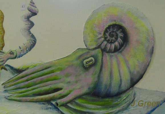
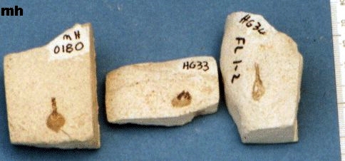
John Green - Fossils from the Welton and Burnham Chalk Formations of Lincolnshire'' [display]
John Green - ''The benthic palaeocommunity of the Burnham Chalk Formation of Lincolnshire ( Upper Turonian, Plesiocorys ( sternotaxis ) plana biozone )"
The Burnham Chalk Formation in Lincolnshire is particuarly well exposed at the
North Ormsby quarry ( TF 2893 ) and, in North Lincolnshire, at the Ulceby Vale
quarry ( TA 104133 ). Both of these exposures represent important sections of
the Plesiocorys ( sternotaxis ) plana biozone of the Upper Turonian stage.
Biostratigraphical bed by bed collecting by the author, over more than twenty
years, mainly from the North Ormsby quarry, has resulted in the recovery of a
large and varied macrofauna.
Malcolm Hart
The 'Black Band' of the Northern Province is a
well-known feature of the chalk succession in Yorkshire, Humberside and
Lincolnshire, although in the latter county it is black, red and green in a
series of colour zones extending from north to south. It is recorded extensively
in the North Sea Basin and can be correlated widely using geophysical logs.
Though highly variable in detail, it is part of a global event in the latest
Cenomanian. The biostratigraphy and chemostratigraphy show this to be a globally
synchronous event, with regional variations caused by local situations. Though
exceptionally well-studied there are still debates as to its formation. In this
case the uniformitarianism approach does not work as, if one studies the
interaction of the modern oxygen minumum zone (OMZ) and present-day continental
shelves, there are no black, organic-rich sediments with unusual assemblages of
benthic foraminifera to be found. Despite this, the OMZ is widely invoked in
many interpretations of these latest Cenomanian events. Why, therefore, are oil
source rocks in Brazil, Angola, Texas, Tunisia, etc., found from this geological
interval and does the formation of the 'Black Band' still help in our
interpretations? Silled-basins, high productivity, slow sedimentation, dinocyst
'blooms' and a fragmented Cretaceous ocean system all figure in the on-going
debate.
Mike Horne - "Chalk Biostratigraphy – can we get
it right, please?
We all use the macrofossil biozones when we write or talk
about the Chalk – but do we really know what they are? Some of them are just
vague, for example one of the zones in Yorkshire is named after a misidentified
fossil that occurs in only a small part of the sequence. None of the zoned have
been defined using the modern criteria, as far as I know. How can we compare the
biostratigraphy of different provinces if the researchers are not using a
commonly agreed scientific standard?
Is it not time to define the macrofossil biozones to give
them scientific credibility? Could we abandon the existing zones in favour of
ones based on different fossil groups that could give us better resolution? Are
they still relevant now that we have more accurate lithostratigraphy,
chemostratigraphy and event stratigraphy?
Danes Dyke or South Landing – To examine the Flamborough Formation –
flintless chalk and discuss interpretation of
the macrobiostratigraphy.
Small scale faulting and deformation and the origin
of the valley
To examine pre-glacial quaternary deposits.
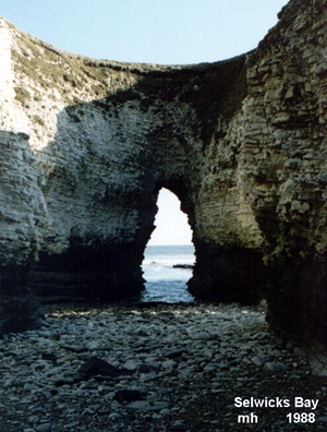
Selwicks Bay –
To examine the top of the flinty Burnham Formation and
the base of the flintless Flamborough Formation.
Discuss the formation of flint
Examine major fault and associated folding.
Examine sedimentary structures in the Chalk that
indicate basin subsidence.
Safety, ethics & logistics–
Hard hats and non-slip footwear must be worn.
The
sites are SSSIs so please restrict you collecting from
in-situ material.
There is a Marine No Take Zone at one of the sites which means that material
with living plants or animals attached must not be removed.
Refreshments will not be provided – please bring your
own food and drink. For delegates using their own transport – there are pay &
display parking fees to be paid at the sites. The field meeting will end about
3pm. We aim to return to the University of Hull by 4-30pm and if requested the
coach will take delegates to the Transport Interchange..
Stratigraphically, the offshore wind farm areas span all the
onshore Chalk formations especially the Northern Province formations present in
the Lincolnshire and Yorkshire Wolds. Cored-boreholes illustrate that the
detailed Iithostratigraphy can be extrapolated offshore supported by key fossil
marker beds. There are, however; some differences offshore especially off
Norfolk where there are variations in lithology not represented onshore and
where there is a mixture of both Northern and Southern Province lithologies.
Seismic sections also illustrate the lateral variations in thicknesses of units
with respect to tectonic structure. The offshore successions have added to our
knowledge and understanding of the onshore Northern Province Chalk.
A chance discovery of trace markings and fossils of
sponges inside the upper rims of Paramoudra on the North Norfolk coast which led
on to the examination of in-situ flints shows that silica gel was beginning to
lithify on the Chalk Sea floor around and in conjunction with the sponges.The
sea bed in this area was between a series of basins and sponges were making
their own protection from the effects of currents in the form of Paramoudra and
Silica Bioherms.Further investigation has revealed the migration of elements
within Flint and the photovoltaic action of sunlight are producing banding,
secondary silica and stones that grow in the topsoil.
The Chalk of the Northern Province has its own
lithological character that differs significantly from the soft chalks of the
Southern Province. This has led to the development of separate
lithostratigraphic schemes for the two provinces. In the Northern Province,
Chalk sedimentation began in the Middle Albian, and onshore sections extend up
into the Campanian. The fauna of the Northern Province also contrasts with that
of the Southern Province, and there are more belemnites and inoceramids and
fewer ammonites; there are also differences in the ranges of the microfossils,
particularly foraminifers. In the Albian, correlation of the Hunstanton (Red
Chalk) Formation can be achieved using belemnites and inoceramids, and rare
ammonite records.
The Cenomanian has a distinctive stratigraphy that can
be traced across the Northern Province and thickens towards Speeton where
bed-for-bed correlations are possible with the chalk-marl couplets in the Lower
Chalk of the Southern Province, using faunal and chemostratigraphic marker
events such as pulse faunas, inoceramids and carbon stable isotope peaks. Faunal
studies for the Turonian to early Campanian can be tied to a detailed marker
stratigraphy defined by flint layers and bentonites, allowing a detailed
correlation across the province. Inoceramids provide the most suitable
biostratigraphic markers, with belemnites and crinoids (Marsupites and
Uintacrinus) being valuable in the Santonian and Campanian. The crinoid zones in
the Upper Santonian show a particularly thick, development on the Flamborough
coast, and represent amongst the thickest development of these zones in chalk
facies. Stage boundaries can be established by use of biostratigraphic and
chemostratigraphic indicators.
Copyright - Hull Geological Society 2015
Registered Educational Charity No. 229147
updated 14th August 2015